🌐 »
HIKE TO THE PHA NGERN CLIFF VIEWPOINT
WALKING TIME - 2 h
DISTANCE - 2,7 km
ALTITUDE DIFFERENCE - + 580 m
DIFFICULTY - difficult
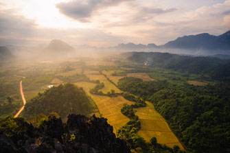
Slowly the sun disappears behind the green mountains of Vang Vieng. The colorful hot air balloons end their short ride and we enjoy the spectacle all alone at dizzy heights. However, this moment also has its price, because you can reach the high vantage point only through a strenuous hike.

To get to the starting point of the hike, you first have to cross the Nam Song River and then follow the road towards Blue Lagoon 1 for 2.4 kilometers. In a left turn, a small brown sign points to the Pha Ngern Cliff Viewpoint and the associated gravel road. After a few hundred meters you will pass a barrier. At this gate the entrance fee of 10,000 Kip (~ 50 cents) per person is collected and afterwards you can park your scooter on the small parking lot. A stand supplies the visitors with the most necessary things before they start their way up. Since the sun sets at 5:30 pm during our visit to Vang Vieng and we planned 2 hours for the climb, we left accordingly at 3 pm. We have one more hint! There are two viewpoints with almost identical names. In Google, the one described in this blog is called "Pha Ngern Trailhead". So be sure to check beforehand to make sure you're going to the right one!


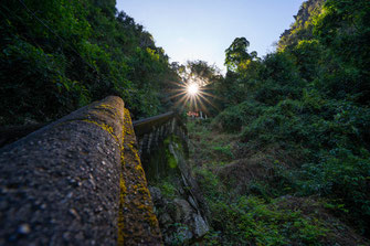
From here the fun begins! At first, there are still concrete steps leading up, but after a few meters the narrow path winds its way over stick and stone. Partly there are railings and ropes. After about 15 minutes of walking, we reach a small platform. Time for a short breather. We are drenched in sweat, the heat is stifling and the high humidity of the jungle does the rest. Our goal is to be at the highest viewpoint in time for sunset. Therefore we hike on and after a total of 45 minutes and 1.6 kilometers we reach the first of the two viewpoints. To get here, you have to turn left at the fork about 50 meters before the viewpoint. A small hut provides thirsty hikers with cool drinks. We take a seat on one of the temporary benches and contemplate the panorama. High mountains covered with dense jungle build up in front of us. In the valley we see isolated cows walking across the rice fields and in the distance the town of Vang Vieng.

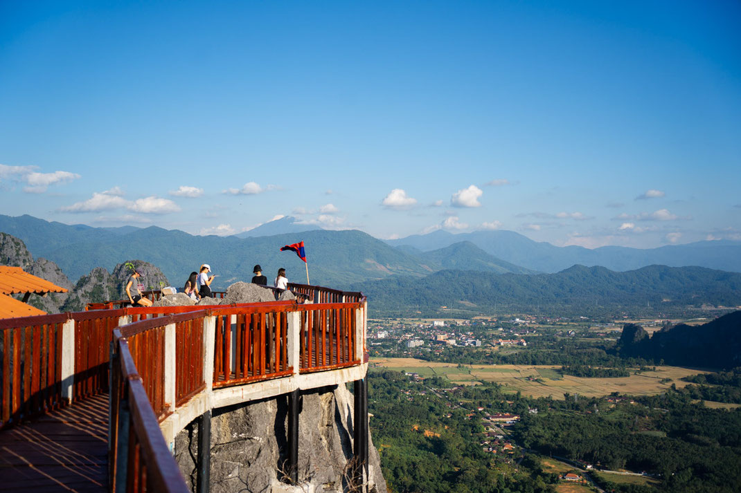
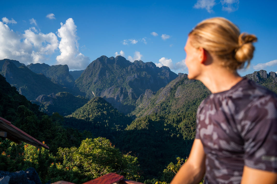

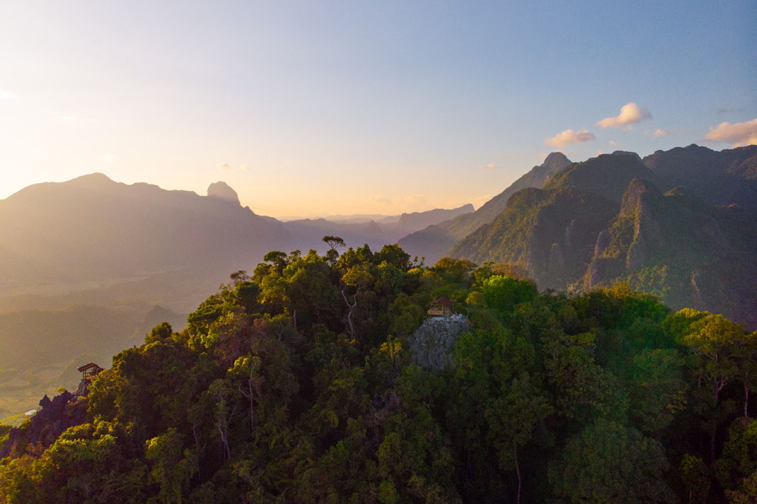
We let our gaze wander and get stuck on a board shack far above our current vantage point. This must be our actual destination, but doubts rise in me. The climb here is already energy-sapping and there are another 250 meters of altitude to the highest point. The clock already shows 4 p.m., so we have to hurry. We climb down the steps to the junction and march along the narrow path to the right. This becomes more and more impassable and leads in part over large boulders and slippery roots. I keep asking myself why I'm doing this. But when we finally reach the summit after another 45 minutes, I find the answer. Exactly because of it! The panorama is breathtaking, the sky slowly turns orange and the first hot air balloons rise in the distance.
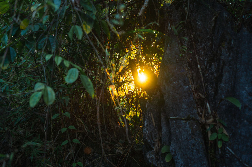


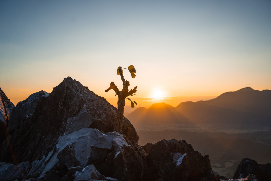

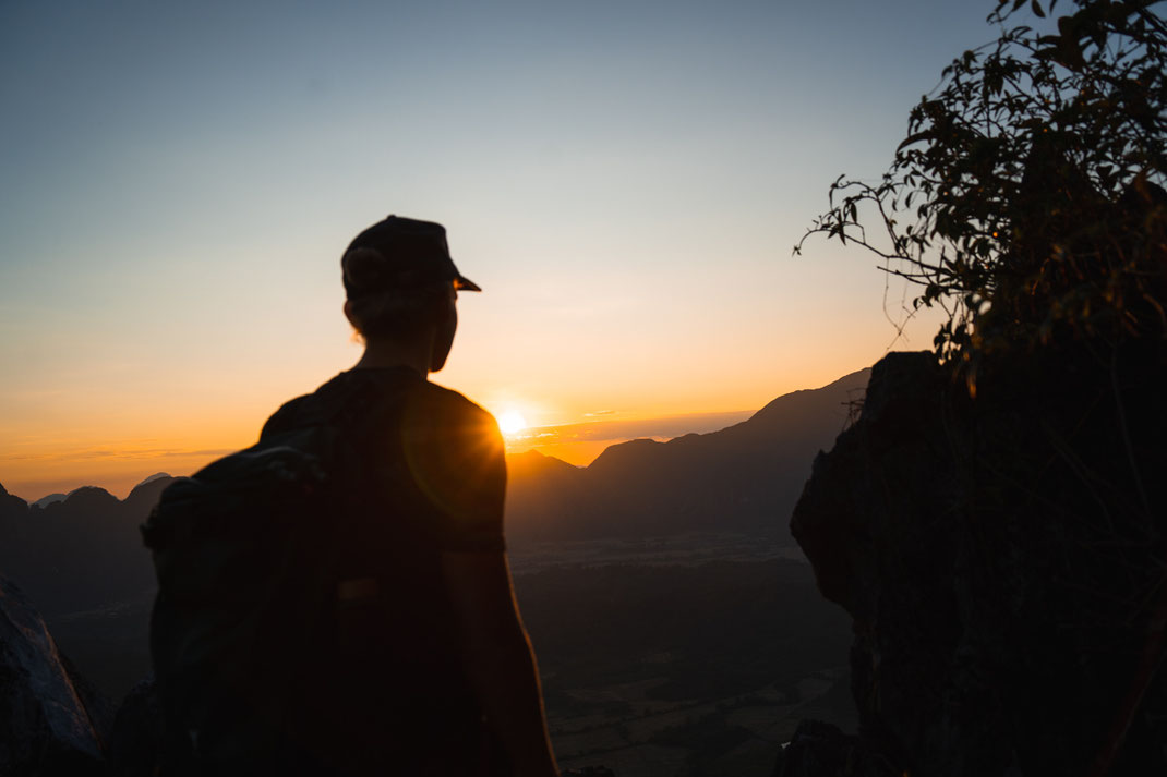


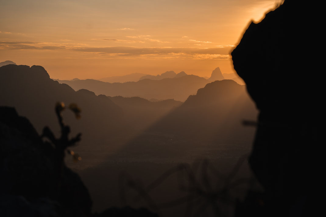
From this point, however, you can not watch the sunset, for this you must follow a small trail, which is marked with red arrows, through the thicket. At the end, a ramshackle wooden hut and a magnificent view of the region await you. On closer inspection, we can even make out one of the Blue Lagoons of Vang Vieng. The sun slowly disappears behind the ridge in the distance and gradually it gets dark. We make our way back. Armed with our headlamps we follow the path down into the valley and after another 45 minutes in the darkness we reach our scooter relieved and exhausted.

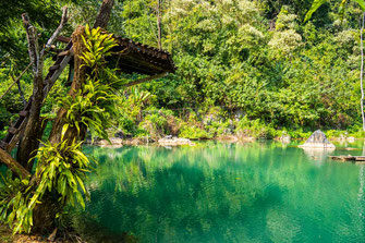
What an experience! The Silver Cliff Viewpoint, as this is also called, is our highlight in Vang Vieng. The strenuous hike cries out for a rest the next day and what better place than the famous Blue Lagoons of Vang Vieng? If you want to see our hike to Pha Ngern Cliff Viewpoint, check out our video of the climb.